Distance: 6.8 miles round trip (10.9 km)
Elevation: 6,100 - 7,242 feet (1,860 - 2,207 m)
Difficulty: Moderate
Season: May to October
 |
| View of Harney Peak (far left distance) from near start of the #9 trail |
Owing to its status as the highest peak in South Dakota, the highest peak in the United States east of the Rockies, and one with panoramic views of the entire Black Hills region and the plains and badlands to the east, Harney Peak is hike extensively, even by many people you usually don't see on a hike that climbs over 1100 feet in elevation or is nearly 7 miles long.
But, despite the crowds, this mountain is absolutely well worth the effort. It is best to get started early in the day, not only to avoid the crowds, but also to avoid the big thunderstorms that can build quickly in this region of the country. Remember, at the summit, you are 1000 feet above all of the other peaks around you, so if there is lightning, this is where it will strike.
There are several ways to get to Harney Peak trailhead. The trailhead is located at popular Sylvan Lake along the famous Needles Highway. Once at the trailhead, there are two routes you can take, which provides for an opportunity to make a loop out of it.
 |
| On the way up, you will pass lots of dead and dying trees due to mountain pine beetle |
The shorter way up, which is less scenic and more crowded, is the #9 trail. It is well marked and wide and you just follow it up a little over 3 miles to the summit. About 1/2 mile from the summit, the #3 trail branches to the right. Remember that, because it is the way you will be heading back.
 |
| Just before the tower, there is a little tunnel and some steep metal stairs |
Just about a quarter mile to the summit, the Harney Peak Lookout spur trail will branch left and head up to the rocky summit. There is a hitching post for horses, then a set of steep metal stairs before arriving at the lookout tower, built in the 1930's by the CCC.
 |
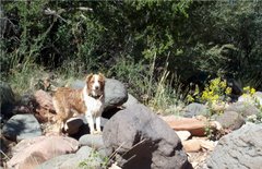
| Of course I am sweaty. That was a hot steep climb. Hilina took her nap and was feeling quite rested at the top |
From the summit, the views are magnificent. You can see almost the entire Black Hills region. To the north are Mount Terry and Mount Roosevelt (talked about on a previous post). All around to the east is the limestone rim that contains the granite core.
 |
| Limestone rim in the distance |
The Black Hills are sort of a mountain range in reverse. The granite core is really ancient rock, some over 1.6 billion years old. It was covered up by limestone in shallow seas about 350 million years ago, and later by sandstone. But, as the range uplifted 60 mya into a dome, at a height of 15,000 feet, the top younger materials eroded first, such that the core was exposed last and remains the highest area, while the lower sections of the dome on the edges are the youngest materials.
 |
The view east towards the prairies and badlands
Backside of Mt. Rushmore is visible as rock wall slightly right |
 |
| Cathedral Spires and "The Needles" to the south |
 |
| The view to the north |
On the way down, you turn left at Trail #4 and follow it down. It seemed EVERYONE was taking the same #9 back that they came up. So, we had #4 to ourselves. In addition, it was the way more scenic route. That is because it takes you right into the heart of the Cathedral Spires and past Little Devil's Tower.
You stay on #3 as it passes #7 Grizzley Bear Trail. However, when you reach the junction with the #4 trail stay right and follow #4 back to the campground. Shortly thereafter, you enter the Cathedral Spires area.
There is one confusing spot, where you encounter a sign saying Cathedral Spires downhill and to the left and Little Devils Tower straight. Just stay straight. Later the Little Devil's Tower spur will branch right, which you can ignore. The trail eventually arrives at a parking lot. But, if you continue on the #4, it will take you back to Sylvan Lake in about another 1/2 mile.
 |
| Cathedral Spires and yes that is a rock climber on top of the spire near the center |


