Distance: 7.7 mile loop (12.4 km)
Elevation: 1,545 - 2,900 feet (470 - 885 m)
Difficulty: Moderate
Time of Year: November - April
Located on the western edge of the sprawl of the Phoenix metropolitan area is a beautiful stretch of Sonoran Desert set aside by Maricopa County for the enjoyment of all. The White Tank Mountains Regional Park offers Phoenicians and visitors alike an opportunity to hike in an area with a true wilderness feel right outside of the ever expanding housing developments and strip malls of the western suburbs. The Mesquite Canyon Loop offers hikers a chance to go deep into the White Tank Mountains to see some year-round springs and green vegetation in the middle of this bone-dry area.
 |
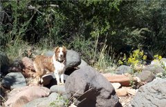
| Our little junior ranger out on the trail on her 5th birthday |
To get to the trailhead, head into Surprise, AZ using the Loop 303 from I-10 west of Phoenix or I-17 north of Phoenix. From Loop 303, look for the Olive Road exit and follow it west 5 miles to the entrance to White Tank Mountains Regional Park. The day fee for the park is about $6 or camping at $17/night. Once in, drive up the main road until Waterfall Canyon Road and turn left. Follow this to Ramada Way, turn left again and park at the trailhead parking lot. One warning, get there early if you want any solitude, because this is a very popular hike! There will be lots of people on the trail.
 |
| A view across the Phoenix Basin |
The trail starts out across the bajada and then up into a small canyon. The trail will switchback a few times onto the slopes and then will cross the wash as it steepens. There are a number of fences to prevent people from cutting the switchbacks and there apparently used to be a trail going straight up the drainage that is now closed. The trail will climb steeply out of the drainage to the ridge top above. At the first saddle, there is a minor summit that you can climb to the top of for a panoramic view across the entire Phoenix Basin. You can easily see Downtown Phoenix, the football stadium in Glendale, and even the Four Peaks and Superstition Mountains way off in the distance if the pollution isn't too bad that day.
The trail then heads into Mesquite Canyon proper. Down below, you will see why this is called the White Tank Mountains, as where water gathers in the dry washes and pools, the rock is stained white. The trail will stay above the canyon floor on the sides of the ridge. But, there will be pools of water visible below with green algae stains and lusher patches of vegetation, including grassy flats. These are critical water sources for desert animals such as bighorn sheep, desert tortoises, and javelina.
 |
| Looking up Mesquite Canyon |
The trail will drop into the wash in a flatter section with many large ironwoods and palo verde to provide shade. Here the loop breaks left and right. You can follow the Mesquite Canyon Trail straight or the Willow Canyon Trail to the right. If you go counter-clockwise, you will climb a ridge separating Mesquite Canyon and Willow Canyon. Then you will drop down and follow Willow canyon with additional pools and white tanks in the canyon bottom below.
The trail will then work its way along the canyon, contouring the sides, until it drops down and crosses the wash as it widens out. Shortly thereafter, you come to a trail junction with Ford Canyon Trail. Stay left and the trail will cross the wash again and then climb steeply up a series of switchbacks toward the ridgetop. Just short of the top, you will meet another trail junction. This is Mesquite Canyon Trail again.
Turn left and follow it as the climbs a bit further and crosses over the ridgetop at the back of the Mesquite Canyon. Then the trail descends quickly to the basin bottom and meets back up with the Willow Canyon junction you saw previously, making the loop complete. From here, just retrace your steps back to the trailhead. Whether you happen to live in the Valley, are coming down to warm up in winter from the Mogollon Rim, or are visiting for Spring Training, this is a great trail to experience the true Sonoran Desert just outside of the urban jungle to stretch your legs.


